WINDEX: The Dawn of GPS Reflectance for Ocean Surface Wind Measurements
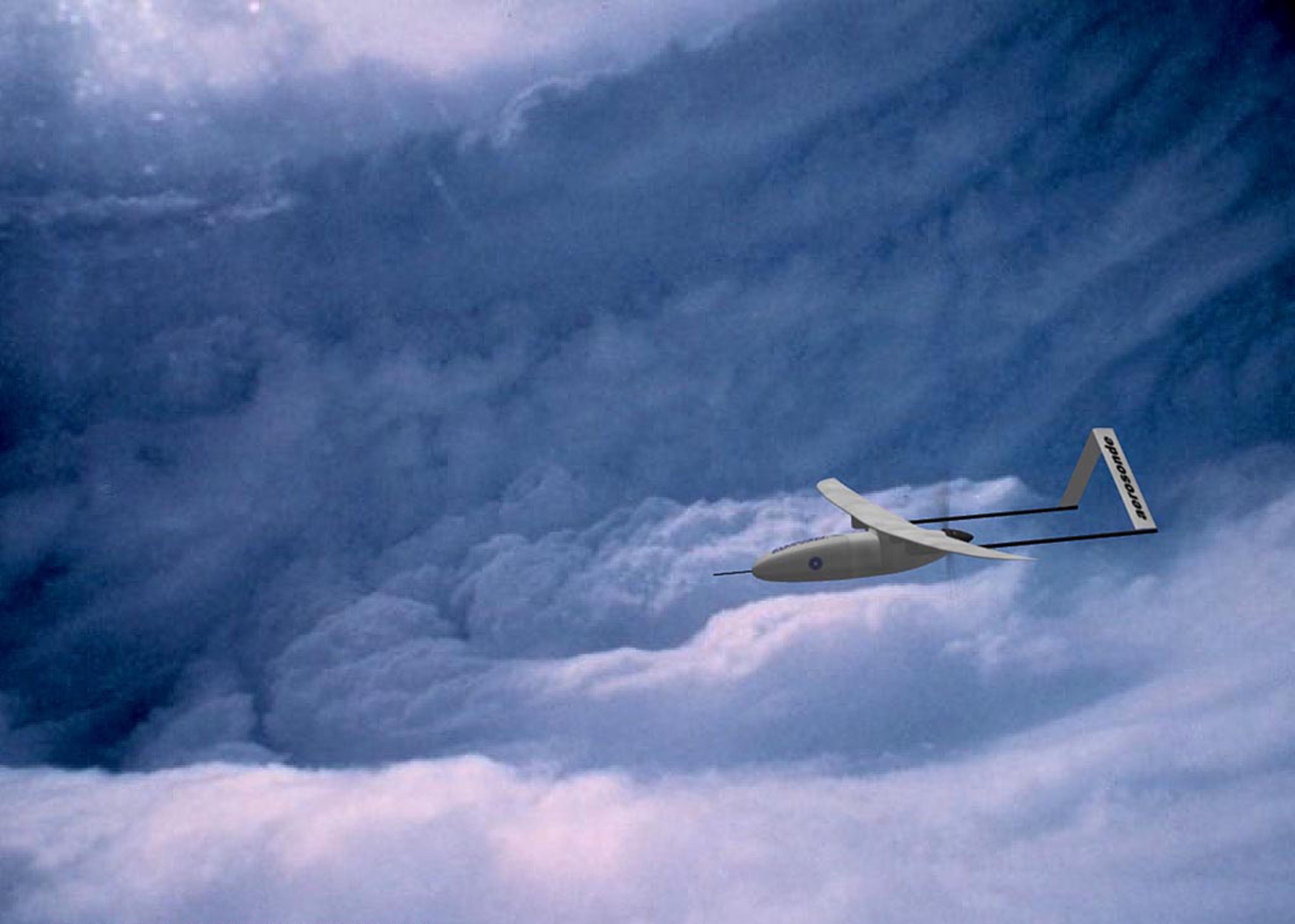
Early testing of WINDEX utilized several airborne platforms, including a first-generation AAI Aerosonde UAV.
In the mid-1990s, a presidential executive order made available the full precision of the Global Positioning System, or GPS, to the public. An explosion of applications followed, from car GPS to cell phone maps to shipping container tracking devices.
At the time, Stephen Katzberg of at the NASA Langley Research Center (LaRC) wondered about the reflection of L-band GPS signals off the surface of the ocean: “What’s the effect of water roughness?” and “can you relate signal disturbance to the wind that creates that roughness?”
As it turned out, you can. Water is like a polished mirror for GPS, and wind acting on a body of water increases the roughness in the water’s surface, causing detectable changes in the signal reflection.
With funding from ESTO and LaRC, Katzberg developed and tested the Wind Explorer (WINDEX) airborne instrument, which successfully detected the variances of the reflected signal and, using a processing algorithm, correlated those properties to determine surface wind speed.
With a low mass/volume/power instrument package, WINDEX could be flown on almost any platform, and it saw initial test flights on both NASA’s Boeing 757 and the diminutive AAI Aerosonde UAV (3.5 m wingspan). In the early 2000s, the instrument was installed on the NOAA P-3 Hurricane Hunter ‘Miss Piggy’ and proved its value for near-continuous surface wind measurements alongside buoys and dropsondes data.
WINDEX-derived GPS instruments are today ubiquitous tools for storm tracking, weather forecasting, and the characterization of ocean wind fields, and they can still be found onboard the NOAA Hurricane Hunters.
WINDEX also led to the development of the NASA Cyclone Global Navigation Satellite System (CYGNSS) – eight micro-satellite observatories launched in 2016 that make frequent measurements of ocean surface winds throughout the life cycle of tropical storms.
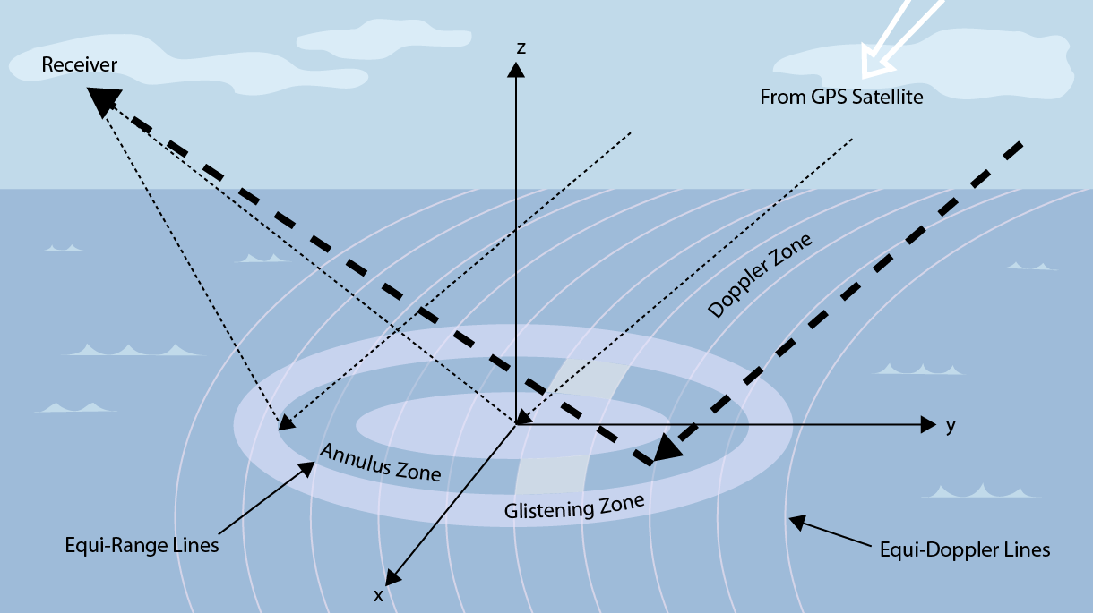
Ocean-reflected GPS signals take the form of nearly concentric ellipses. Their surface areas contribute to the detected signal so long as there are waves with correct slope to redirect the incoming GPS.