UAVSAR: A Workhorse Airborne Instrument for Earth Deformation Measurements
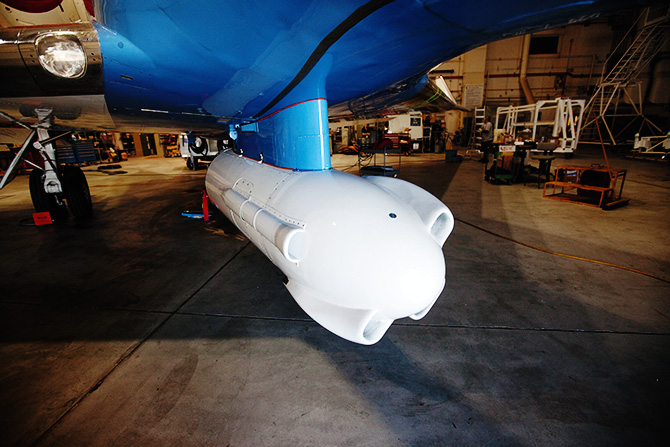
The UAVSAR pod hangs below the belly of NASA’s Gulfstream III at the Armstrong Flight Research Center. The four vents around the pod are used to air-cool the radar equipment during flight. (Image Credit: Dave Bullock/Wired.com)
NASA’s Uninhabited Aerial Vehicle Synthetic Aperture Radar (UAVSAR), an airborne L-band radar developed at the Jet Propulsion Laboratory (JPL) with funding from ESTO’s Instrument Incubator Program, has become an invaluable airborne tool for solid Earth and glaciological sciences as well as disaster management.
While space-based assets can carry out deformation measurements of the Earth’s surface, revisit times on the order of days to weeks limit their effectiveness in the study of rapidly changing features. Based on radar repeat pass interferometry, UAVSAR can conduct multiple flights over an area of interest within minutes, making surface deformation measurements to millimeter-level accuracy of earthquakes, volcanic deformation, forest and vegetation structure, ice, hydrology, and other natural processes.
The early technology development of UAVSAR, which began in 2004, focused on two key challenges. First, repeat pass measurements needed to be taken from flight paths that are nearly identical. UAVSAR utilizes real-time GPS that interfaces with the airplane’s flight management system to conduct the repeat flight to within the same 10 m path. Second, the radar vector from the aircraft to the ground target area must be similar from pass to pass. This is accomplished with an actively scanned antenna designed to support electronic steering of the antenna beam with 1º increments over a range of ± 15º in the flight direction.
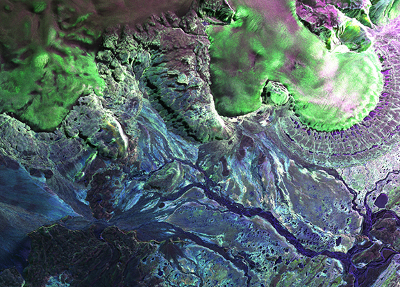
Polarimetric image of Hofsjokull, Iceland, taken by UAVSAR in June 2009. The blue areas are bare ground surfaces and the green areas are ice. (Image Credit: NASA)
Now a ‘facility-class’ instrument, UAVSAR has logged over 300 flights since 2008 and is the most-requested airborne tool in NASA’s portfolio. Many of these flights directly supported disaster response efforts, such as mapping faults following earthquakes in Haiti (2010), imaging the Deepwater Horizon oil spill (2010), analyzing sinkholes in Louisiana (2014), and studying landslide dangers in California (2019).
UAVSAR has also participated in numerous airborne campaigns, including SnowEx, Delta-X, Arctic-Boreal Vulnerability Experiment (ABoVE), and Oceans Melting Greenland (OMG). Additionally, several space missions – such as NASA-ISRO SAR (NISAR), Soil Moisture Active Passive (SMAP), and Ice, Cloud and land Elevation Satellite (IceSat-2) – have utilized UAVSAR for formulation and calibration/validation activities.
To learn more, visit the UAVSAR project page at JPL.