A Sensor Web Approach for Soil Moisture
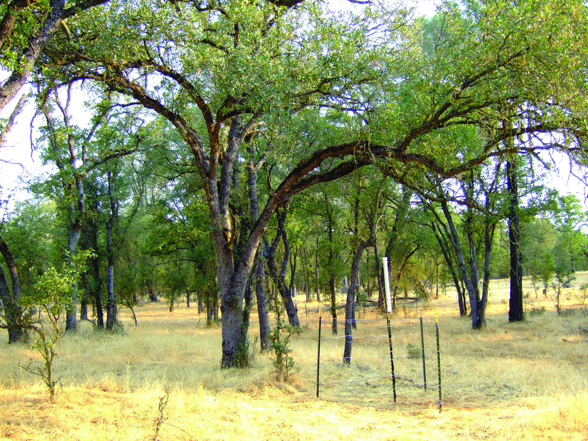
A sensor node at the Tonzi Ranch SoilSCAPE site in California. (Credit: M. Moghaddam, USC)
From agriculture to weather prediction, accurate measurements of soil moisture content help answer a variety of questions, such as how water is stored and distributed in Earth’s soils, how ecosystems function in variable conditions, and how the water cycle is globally regulated. With a series of awards from ESTO’s Advanced Information Systems Technology (AIST) program, the SoilSCAPE project has helped provide answers while also supporting the calibration/validation activities of emerging airborne and space borne instruments.
SoilSCAPE – short for Soil moisture Sensing Controller And oPtimal Estimator – is a series of field sites, each consisting of dozens of wirelessly connected in-situ soil moisture sensors, installed in several U.S. states and New Zealand. These smart, low-power, autonomous sensor webs are designed to communicate with each other to adaptively and efficiently measure soil moisture at various depths. Following the installation of the first field site in Anne Arbor, MI, in 2007, at least 12 networks have been brought online, including in Oklahoma, Colorado, New Mexico, Arizona, Alaska, and California.
Funded through the Advanced Information Systems Technology Program (AIST) program, the SoilSCAPE sensor webs use guided and adaptive sampling strategies to conserve power when not needed and respond quickly to detected changes, ramping up data collection after a rainstorm for example. The SoilSCAPE sites feature a variety of surface and subsurface sensors, arranged in grids of nodes, with centralized controllers that task the nodes to take measurements as well as collect and forward their data. To aid in satellite calibration/validation, the sites are designed to measure soil moisture processes at a scale that mimics the ground footprints of remote sensing instruments in orbit.
During its first few years on orbit, the Soil Moisture Active Passive (SMAP) satellite, which launched in 2015, utilized a SoilSCAPE site in the eastern eastern Sacramento Valley known as Tonzi Ranch for its calibration. The 150 sensor nodes spread over Tonzi Ranch’s western savanna ecosystem of grassland, pine, and oak provided ground truth and aided in the modeling of complex hydrologic behavior.
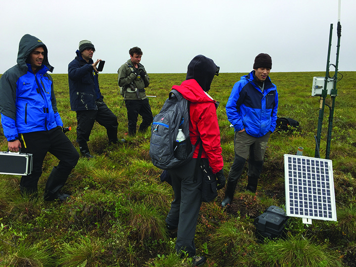
Members of the SoilSCAPE team inspect sensors at a field site in Happy Vally, Alaska. The spongy, uneven surface is known as thermokarst and made walking exceptionally difficult. (Credit: K. Hines, NASA)
Beginning in 2016, SoilSCAPE sites in Alaska also supported the Arctic-Boreal Vulnerability Experiment (ABoVE) field campaign, a multi-year airborne and ground-based science investigation to study the impact of climate change on ecosystems in the boreal and arctic regions of North America. More recently, SoilSCAPE sites in New Zealand have been setup to explore the sensitivity of Cyclone Global Navigation Satellite System (CYGNSS) satellite measurements to surface soil moisture and temperature.
SoilSCAPE is also part of the the International Soil Moisture Network (ISMN), an international cooperative effort that maintains a global in-situ soil moisture database, an essential tool for land surface, climate, and hydrological modeling as well as for the validation of satellite data. SoilSCAPE data is used regularly by the scientific community, with 100s of user downloads every year through the ISMN web portal. More information on SoilSCAPE, including access to SoilSCAPE data, is available online at: http://soilscape.usc.edu