MFLL: A Capable, Adaptable Lidar Instrument
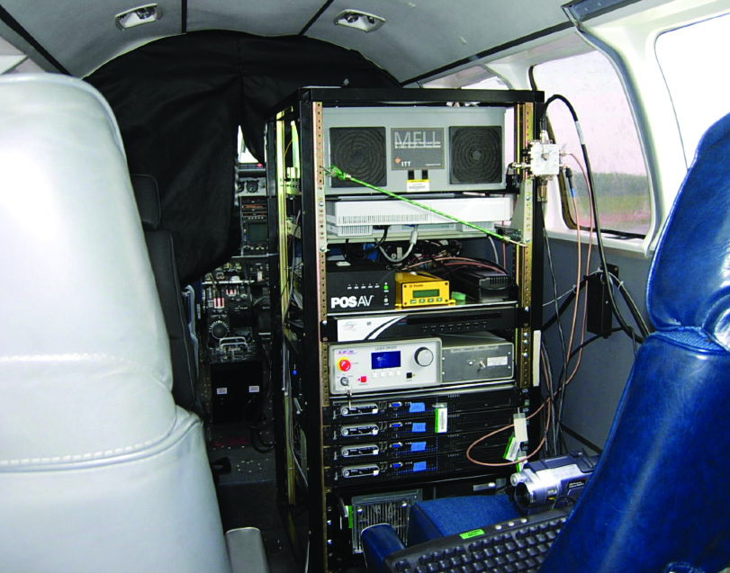
The MFLL instrument mounted inside a Beechcraft B90 aircraft for early engineering test flights (Credit: M. Dobbs)
Developed by ITT Industries under a 2004 Instrument Incubator Program award, the Multi-Functional Fiber Laser Lidar (MFLL) is an airborne lidar system capable of topographic ranging, aerosol/cloud sensing, and atmospheric profiling. Originally conceived as a testbed for the lidar technologies required by the Active Sensing of CO2 Emissions over Nights, Days, and Seasons (ASCENDS) mission concept, MFLL has been used extensively for airborne science.
Originally targeted at ice sheet topography measurements, the MFLL was designed with all-fiber laser operation. MFLL’s diffractive optics enabled custom imaging formats and cross track imaging without moving parts. Compared to the contemporary state-of-the-art, the MFLL was two-to-four times smaller with twice the wall plug efficiency, resulting in an instrument that was less expensive to operate.
From 2016 to 2019, the MFLL was flown for more than 600 hours onboard the NASA C-130H Hercules aircraft, largely in support of the Atmospheric Carbon and Transport – America (ACT-America) airborne campaign. The MFLL helped quantify sources of regional carbon dioxide, methane and other gases, measurements that were used to document how weather systems transport these gases in the atmosphere. Comparisons with other instruments during the ACT-America campaigns demonstrated MFLL’s accuracy for carbon dioxide column measurements at 0.65 ppm.
Although originally fielded using a fiber amplifier tuned at 1.57 μm, the technology approach resulted in an instrument that could be implemented for a range of missions at other wavelengths, including for vegetation, ice sheet topography, and bathymetry, as well lunar and planetary surfaces.