GeoTASO Instrument Paves the Way for TEMPO Mission
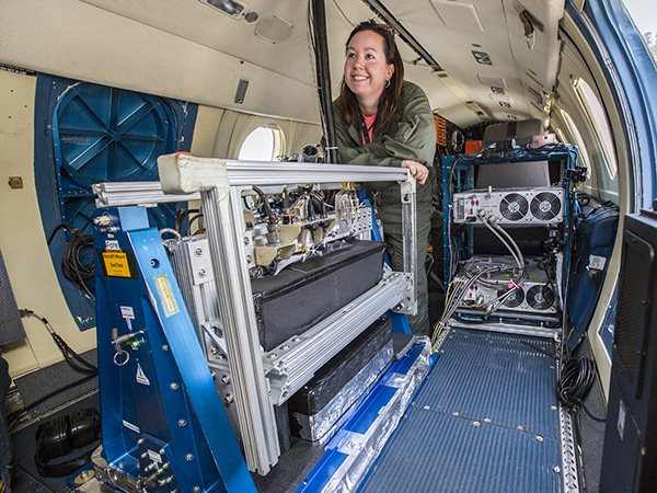
GeoTASO (foreground) being prepared for a LISTOS science flight on NASA’s HU-25 aircraft. (Credits: NASA/David C. Bowman)
The Geostationary Trace gas and Aerosol Sensor Optimization (GeoTASO) instrument, developed through a 2010 Instrument Incubator Program award by Principal Investigator James Leitch at Ball Aerospace, is an airborne, nadir-viewing, UV-Visible spectrometer that measures aerosols and trace gases like ozone and formaldehyde.
Originally conceived as a precursor for the air quality measurements called for by the Geostationary Coastal and Air Pollution Events (GEO-CAPE) decadal survey mission concept, GeoTASO has become an airborne science instrument as well as a test bed for the Tropospheric Emissions: Monitoring of Pollution (TEMPO) mission.
TEMPO launched in April 2023 and includes a UV-Visible sensor, also built by Ball Aerospace, which will provide hyperspectral data very similar to that of GeoTASO.
In 2013, GeoTASO teamed up with several other instruments for a multi-year airborne science campaign called DISCOVER-AQ. Onboard the NASA HU-25C Falcon, GeoTASO flew higher and faster than the other instruments, which offered satellite-analog measurements to advance the TEMPO mission concept and refine its trace gas and aerosol retrieval approaches.
GeoTASO also contributed some 50 flight hours to the Long Island Sound Tropospheric Ozone Study (LISTOS), a 2018 field campaign led by a consortium of state air-quality agencies in the Northeastern U.S.