DAWN: A Robust Airborne Wind Lidar
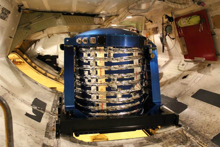
The DAWN instrument mounted in the cargo level of the NASA DC-8 (Credit: NASA)
Developed at NASA Langley Research Center under principal investigator Michael Kavaya, the Doppler Aerosol WiNd (DAWN) instrument is a Doppler wind lidar that provides high-resolution 3D wind measurements. Originally intended as a step toward an eventual spaceborne lidar system, the 2-micron, pulsed, coherent-detection wind profiling system has proven significant utility as an airborne instrument, with numerous flights in support of atmospheric science field campaigns.
A benchtop version of DAWN was first funded in 2004 under the Instrument Incubator Program (IIP), building upon prior work on 2-micron laser development through the Laser Risk Reduction Program (LRRP). A follow-on award through the IIP 2007 solicitation allowed the project team to further package and ruggedize the system for its first test flights.
At the time, DAWN laser pulse energy was the highest to date in an eye-safe wind lidar system – 10 pulses per second at 100 mJ, with 200 ns pulse duration – and provided previously unattainable 3D wind profiles every 3-7 km with a vertical resolution of ~50m as well as 12 line-of-sight azimuth angles that could be processed into accurate horizontal wind vectors and wind variation information.
Beginning in 2010, DAWN was deployed on NASA’s DC-8 aircraft, alongside several other instruments, in support of the NASA Genesis and Rapid Intensification Processes (GRIP) flight campaign, a multi-year effort to study hurricane development.
Several other science campaigns followed, including the 2017 NASA Convective Processes Experiment (CPEX) airborne campaign, which collected data over the Atlantic to study the lifecycle of convective storms. In 2019, DAWN flew in support of calibration/validation efforts of the European Space Agency’s Aeolus mission, a wind-profiling satellite. In total, DAWN has completed over 500 flight hours onboard NASA’s B-200 and DC-8 aircraft.
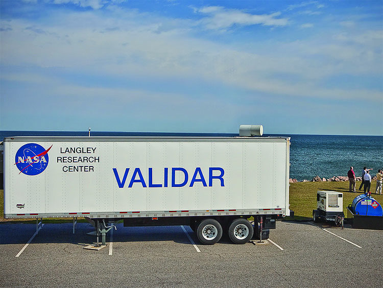
A trailer containing DAWN positioned on a bluff at Fort Story, VA, overlooking the Atlantic Ocean (Credit: G. Koch)
Mapping Wind Farm Sites
In September 2011, DAWN was also temporarily installed on the ground, in a trailer at the Fort Story military base on Virginia’s coast, to assist the Virginia Coastal Energy Research Consortium (VCERC) in determining future offshore wind turbine locations. By scanning the beam up and down, the DAWN team was able to profile winds at various altitudes above the ocean surface corresponding to the height of a wind turbine. The data gathered during the month-long deployment was compared to in situ weather stations and used to determine which regions of the 140,000-acre offshore project contain the strongest, most consistent (and most valuable) winds.