ASCENDS CarbonHawk Experiment Simulator
CO2 Column Instrument Completes Successful Engineering Flights
Andrea Martin, July 2014, andrea.s.martin@nasa.gov
![]()
NASA’s Earth Observing missions are called for, planned, and developed years, even decades, before the satellites are launched. The 2007 National Research Council Decadal Survey recommended that NASA develop and fly the ASCENDS (Active Sensing of CO2 Emissions over Nights, Days, and Seasons) mission to give scientists the data they need to better understand, predict and model climate changes by studying atmospheric carbon sources, sinks, and transport. Today, ASCENDS is in pre-formulation while technologists and engineers design ways to make ASCENDS’ observation goals a reality.
Current and near-term global satellite-based observations of CO2 rely on measurements from passive instruments that use reflected sunlight to measure CO2 concentrations. While these measurements are essential to our current and future understanding of the carbon cycle, passive observations do not provide critical information about atmospheric CO2 column densities when sunlight is not available, either at night or at high latitudes such as northern Europe during the winter and over the poles. Clouds also limit passive measurements. New technologies and instrumentation must be developed that will fill these data gaps and be capable of accurately measuring the total amount of carbon dioxide (CO2) in a column of air from space, one of ASCENDS’ mission objectives. To pave the way for an eventual spaceborne instrument, engineers are developing airborne instrumentation that can collect the necessary data in a similar environment. NASA’s Earth Science Technology Office (ESTO) has funded several technologies to advance the instrumentation and systems needed for this mission, including an airborne instrument, the ASCENDS CarbonHawk Experiment Simulator (ACES).
Led by Principal Investigator Michael Obland of NASA’s Langley Research Center (LaRC), ACES is a new airborne instrument that is able to make measurements of the total amount of atmospheric CO2 from the aircraft to the ground. Working in partnership with ITT Exelis Geospatial Systems, Obland’s team has built on the heritage of Exelis’ Multi-Functional Fiber Laser Lidar to develop an advanced type of carbon sensing lidar.
The ACES instrument consists of a three-telescope design with transmitters for measuring both oxygen (O2) and CO2. The O2 wavelengths are provided via the subsystem built by Exelis investigator Jeremy Dobler and his team with earlier funding from ESTO’s Advanced Component Technology (ACT) program. Detector system advances include a new tactical cooler design and higher bandwidth capability that allow new algorithms to be explored to better distinguish cloud and aerosol layers in the column measurement. Additionally, ACES has 6 times more power than previous similar instruments providing 30 watts total across several wavelengths near a CO2 absorption line. Another key development question the ACES team is hoping to answer is if multiple smaller telescopes could provide the same, if not better, results as a similar instrument that only houses one larger telescope. By using smaller telescopes, the total mass and volume of the instrument could be reduced, an important feature in observation technology development where higher mass equals higher launch costs.
The ACES instrument architecture, including its component technologies, is scalable to ASCENDS mission measurement requirements. But before we send new, unproven technologies to space, they must be thoroughly tested on Earth. To as closely simulate the realistic measurement environments of a satellite, ACES was engineered to take measurements at altitudes over60,000 feet above Earth’s surface, well above most of the atmosphere.
LaRC has a test range for new instruments, but that facility only has a measurement capability of less than 3,000 feet, far too small a sample area to truly evaluate ACES’ performance. According to Obland you “can’t fully evaluate the instrument until you fly high.” To meet this goal, ACES flew its first flight on July 1, 2014 on an aircraft that meets its high-altitude testing needs, NASA’s HU-25 Falcon.
That first flight, as well as the follow-up test and engineering flights, flew in and out of LaRC. The Falcon, flying at an altitude of 35,000 feet, can travel at a maximum air speed of 430 knots (just under 500 miles per hour). ACES’ compatibility with several high-altitude aircraft in NASA’s fleet increases the instrument’s usability for participation in future science campaigns.
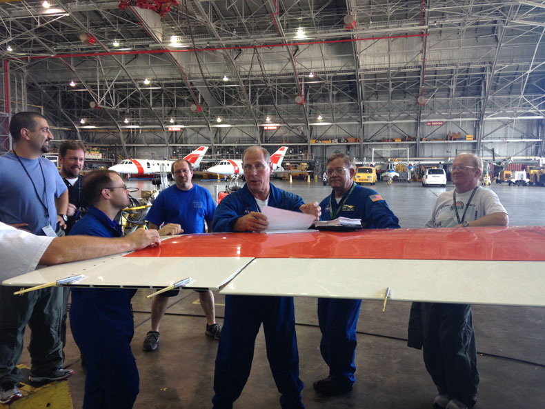
Chief Pilot Rick Yasky giving the pre-flight briefing to the ground and flight crew(Image Credit: ACES Team, NASA).
The engineering flights were able to collect column CO2 data to compare the new instrument’s results with the performance of previous carbon sensing instruments. In addition, the flight team gathered in situ measurements from the aircraft using other Langley research instruments to validate the ACES results with actual CO2 values.
The first flights collected information over the Atlantic Ocean because the ocean provides a uniform background for the measurements. By flying and collecting data over such an environment, it makes it easier for the ACES team to calibrate the instrument and ascertain how well the instrument is functioning as the data is retrieved without the added complications of changing land surfaces. Subsequent flights tested the instruments’ measurements over urban and rural land areas across Virginia, North Carolina, and west into the mountains of West Virginia to test the measurements over changing surface elevations.
ACES, utilizing Exelis’ experience and ACT-funded O2 subsystem, also flew with another first time system, HOPS. HOPS, the High-Speed On-Board Data Processing for Science Instruments, developed by Jeffrey Beyon, of LaRC and his team through ESTO’s Advanced Information Systems Technology program, was designed to enable real-time data processing onboard for very high data volume missions like ASCENDS. Specifically HOPS was designed to produce real-time CO2 and data reduction hardware necessary for ASCENDS success. Like ACES, HOPS is scalable to spaceflight missions. The high speed data processing system was built using commercial off the shelf products already tested for use in space.
HOPS recorded and processed ACES data during several of the test and engineering flights. ACES also recorded its own data, but by flying the two systems together, the project teams were able to test the new systems to validate their results.
In total, ACES, in conjunction with HOPS and the previous O2 system flew for 17.4 hours in six flights.
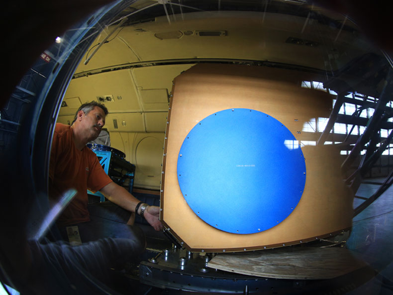
Aircraft mechanic Dean Riddick guides the ACES instrument into position onboard the HU-25C aircraft at NASA’s Langley Research Center.
(Image credit: NASA/David C. Bowman)
While detailed analysis of the data will take several months, initial results from these flight tests indicate that the instrument reached or exceeded design performances. The instruments operated as expected and very precise CO2 column measurements were obtained that the team is excited to evaluate and study.
Because carbon is a topic of such interest at NASA, the ACES instrument is capable of “providing immediately relevant science measurements that are crucial to our understanding of the atmosphere and not just a demonstration of future technologies” says Obland. It is his hope that some day ACES could be available for science campaigns of routine, regional measurements of CO2. Or perhaps, ACES could even be used for calibration and validation activities for other carbon sensing instruments and missions.
“Building and developing an instrument is a process, not an instant success,” says Obland. These first engineering flights were just one step in the technology development path toward enabling the types of measurements needed for ASCENDS. A path enabled by three outstanding technologists brought together under ESTO’s technologies investments. Now that the engineering flights are finished, the ACES team will analyze the data collected to refine the instrument and characterize the areas that were sampled. What started as just an idea built on previous investments and symbiotic technology has led to a new airborne instrument. Someday the technology advanced here may enable spaceborne mission success.