2014 Earth Venture Suborbital solicitation
2014 Earth Venture Suborbital Selections Carry Substantial Technology Heritage
Philip Larkin, November 2014, philip.larkin@nasa.gov
![]()
In November, five new airborne field campaigns were announced as the second cohort of NASA Earth Venture suborbital-class investigations. With flights to begin in 2015, these campaigns will help address pressing Earth science questions, from pollution and greenhouse gas sources to melting glaciers and ocean ecosystems. The campaigns will also prominently feature numerous technologies, new and old, developed through the Earth Science Technology Office (ESTO). Four of the five campaigns include the direct infusion of ESTO technologies, as follows:
North Atlantic Aerosols and Marine Ecosystems Study (NAAMES)
– Michael Behrenfield, Oregon State University
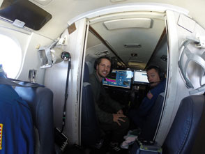
NAAMES will utilize the High Spectral Resolution Lidar (HSRL) instrument to measure the vertical distribution of aerosols within the atmosphere and phytoplankton to three optical depths (~45 m) in the ocean. HSRL was developed and improved under two ESTO technology projects led by Johnathan Hair and Chris Hostetler of the NASA Langley Research Center. At right is HSRL onboard the UC-12 aircraft during the 2014 Ship-Aircraft Bio-Optical Research (SABOR) field campaign.
NAAMES will also fly the GEO-CAPE Airborne Simulator (GCAS) instrument, a high-spectral-resolution ocean color sensor that finds heritage in several ESTO-funded projects led by Scott Janz of NASA Goddard Space Flight Center.

(Image: Richard Hare)
![]()

– Kenneth Davis, Pennsylvania State University
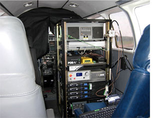
ACT-America will also use the HSRL instrument above, as well as the Multi-Functional Fiber Laser Lidar (MFLL) instrument developed by Michael Dobbs of ITT Excelis. MFLL is a multi-functional system capable of topographic ranging, aerosol and cloud sensing, and atmospheric profiling. A complimentary Oxygen-measuring laser system developed by Jeremy Dobler of ITT Excelis will also be used, and several improvements to the flight system are ongoing under a project led by Michael Obland of NASA Langley Research Center. At left is the MFLL instrument rack onboard a Beechcraft B90 aircraft during its first test flights in May 2008.
(Image: M. Dobbs)
![]()
ObseRvations of Aerosols above CLouds and their interactions (ORACLES) – Jens Redemann, NASA Ames Research Center
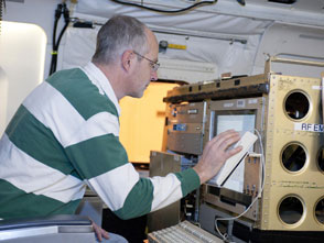
Instrumentation on the ORACLES campaign will include the Airborne Second Generation Precipitation Radar (APR-2), which was originally developed under an ESTO project led by Eastwood Im of the Jet Propulsion Laboratory (JPL). Improvements to the APR-2 are ongoing through a second project under Stephen Durden, also of JPL. At right, Steve Durden checks out the APR-2, which flew onboard the DC-8 aircraft during the 2013 Studies of Emissions and Atmospheric Composition, Clouds and Climate Coupling by Regional Surveys (SEAC4RS) airborne campaign.
Also flying with the ORACLES campaign will be the Airborne Multiangle SpectroPolarimetric Imager (AirMSPI), developed by David Diner of JPL (Learn more about AirMSPI here: http://1.usa.gov/VNBfqw), and the Spectrometer for Sky-Scanning, Sun-Tracking, Atmospheric Research (4STAR) instrument. Upgrades to 4STAR, which uses light from the sun to measure aerosols, gasses, and clouds, are ongoing through a project led by Philip Russell of NASA Ames Research Center.
 (Image: NASA / Tom Tschida)
![]()

Oceans Melting Greenland (OMG) – Josh Willis, Jet Propulsion Lab
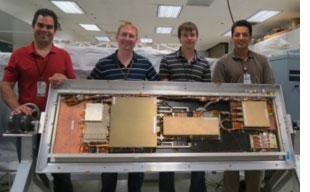
The OMG campaign will feature the Airborne Glacier and Land Ice Surface Topography Interferometer (GLISTIN-A) instrument developed by Delwyn Moller of Remote Sensing Solutions. GLISTIN-A is a Ka-band interferometric radar that can map ice-surface topography with a 10+ km swath at high resolution to provide insights about dynamic glaciers and coastal regions of ice sheets. At left are members of the GLISTIN team with instrument’s antenna panel. Learn more about GLISTIN-A, and its ability to measure ice topography here: http://1.usa.gov/ShIFRO
(Image: D. Moller)