HIWRAP: Seeing Wind from Greater Heights

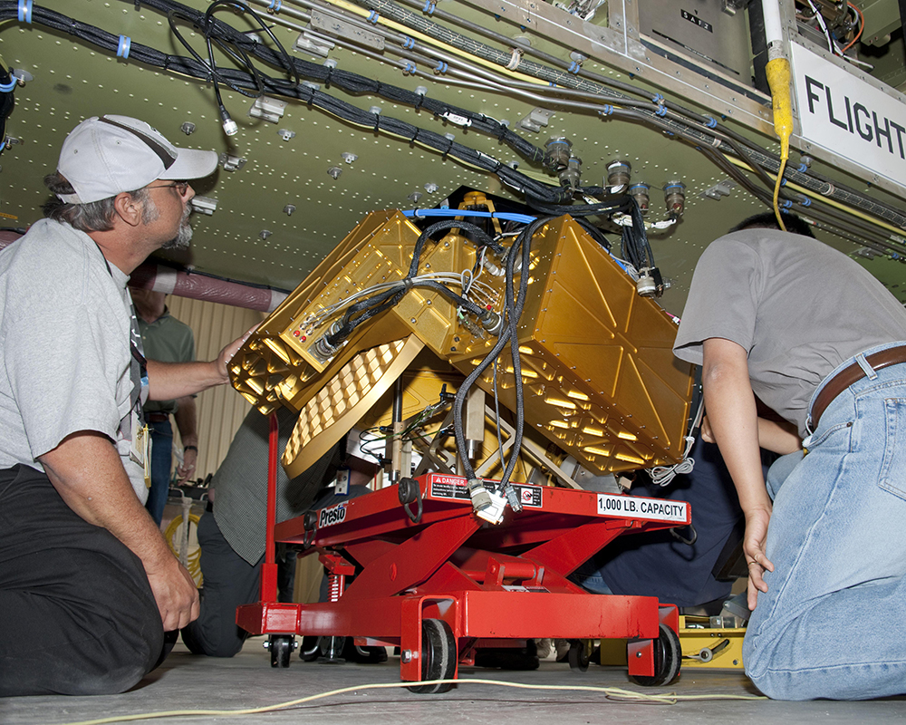
Technicians install HIWRAP on the underside of a NASA Global Hawk in preparation for the GRIP campaign in 2010. (Credit: Tony Landis/NASA)
Completed in 2010, the High-Altitude Imaging Wind and Rain Airborne Profiler (HIWRAP) was developed at Goddard Space Flight Center to enable doppler radar from high-altitude aircraft, including uninhabited aerial vehicles (UAVs). The first unpressurized, high-altitude, solid-state Ka/Ku-band Doppler radar, HIWRAP was designed to measure tropospheric winds, particularly inside storms, and ocean surface winds.
Wind measurements are a crucial puzzle piece in the forecasting of tropical storms, and aircraft-borne Doppler radars have long been primary tools for measuring both horizontal and vertical winds inside rainy regions of these storms. However, standard aircraft have limited range, endurance, and altitude. Smaller, lighter, less power-hungry, and with no need for pressurization, HIWRAP can operate much higher in the atmosphere than previous airborne instruments.
Several technology developments – a compact dual-frequency antenna, solid state transceivers, a new pulse compression waveform, and a digital receiver – were key to these performance advantages and made HIWRAP an ideal payload for NASA’s unique high-altitude aircraft.
Flying onboard NASA’s ER-2 and WB-57 aircraft as well as the Global Hawk UAS, HIWRAP measures winds by analyzing the radar backscatter from clouds and rain drops. Much of the HIWRAP radar system rotates at about 10 rpm, enabling a three-dimensional view of the storms below.
To date, HIWRAP has logged nearly 1,400 flight hours and has participated in several airborne science campaigns, including: Genesis and Rapid Intensification Processes (GRIP), Hurricane and Severe Storm Sentinel (HS3), and Investigation of Microphysics and Precipitation for Coast-Threatening Snowstorms (IMPACTS).