NASA's Space-to-Soil Challenge Selects Winners
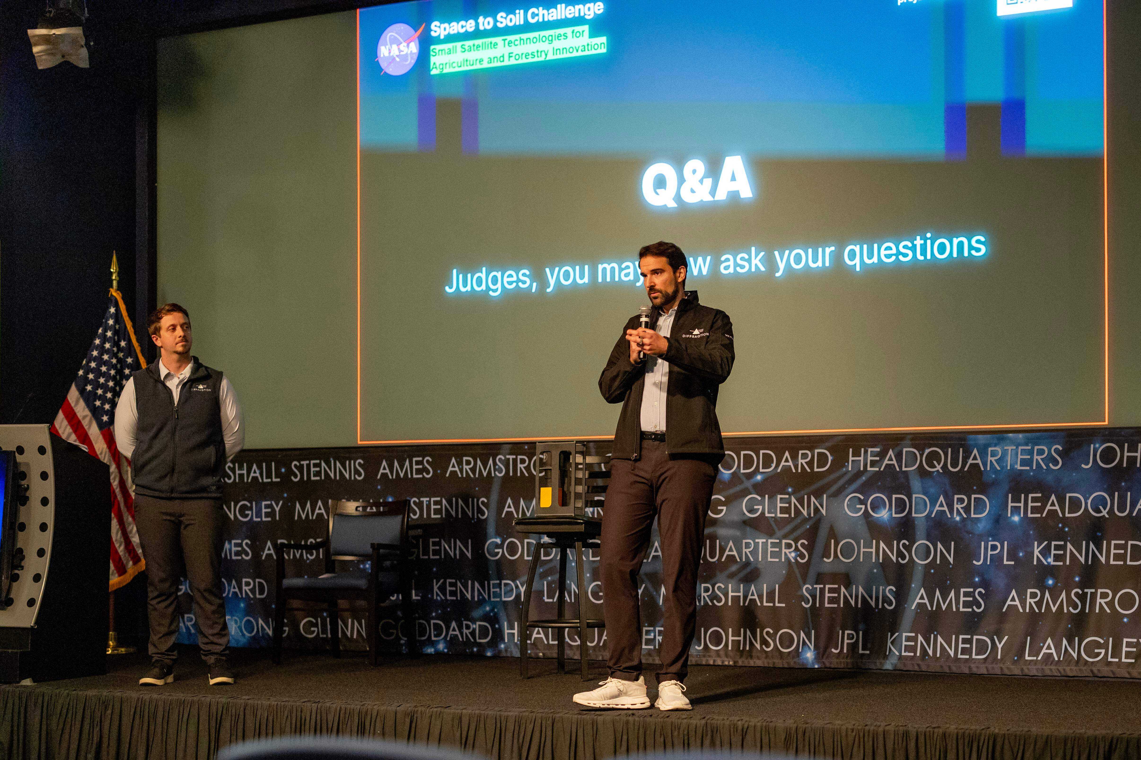
Johannes Galastones, Diffraqtion’s co-founder and CEO, during the pitch competition. (Image Credit: NASA / Paul Padgett)
07/17/26 — To help leverage NASA technology for better agriculture, NASA’s Earth Science Technology Office (ESTO) recently held the Space to Soil Challenge, awarding a total of $400,000 in prizes to innovators pushing the boundaries of satellite intelligence.
The challenge called upon developers, engineers, and scientists to design intelligent onboard systems for small satellites (SmallSates) capable of adapting to Earth’s changing conditions in near real-time. By moving from passive data collection to active, onboard processing, these new technologies promise to revolutionize how we monitor sustainable forestry, land resilience, and agriculture.
Following a competitive Phase One selection process, 10 finalists each received $5,000 and were invited to an in-person Pitch Event to present their solutions and compete for a further $100,000 in funding. Ultimately, three teams were selected as Pitch Event Winners:
- Team Diffraqtion: For their “Quantum Camera Satellite Mission for Real-Time Deforestation Detection.” Instead of capturing raw imagery for ground analysis, this mission employs a quantum camera to perform canopy classification directly at the sensor level. It triggers sub-kilobyte alerts when canopy loss is detected, compressing the time-to-alert from days to minutes and integrating seamlessly into monitoring platforms like Global Forest Watch.
- Team Hydrosat: For their “Hydrosat Onboard Thermal-alert System (HOTS).” This solution uses Hydrosat’s cutting-edge smallsat system in conjunction with NASA ECOSTRESS and Landsat algorithms to develop an onboard data processing system for vegetation thermal anomaly detection. The system is designed for immediate application and scalability, capable of being deployed to millions of end-users worldwide.
- Team LandScout: For “LandScout – Orbital Intelligence.” This onboard intelligence system works with a mobile app where farmers register their crop parcels. Using commercial low-power satellite hardware, the onboard software executes a cascading pipeline using NASA-validated vegetation indices to send confirmed, actionable plant-health alerts directly to farmers’ phones in minutes, enabling intervention before crop damage becomes visible.
“In the ten minutes it will take for me to give that pitch, we will have lost enough forest to cover the entire national mall outside. We want to do something about that,” said Johannes Galastones, Diffraqtion’s co-founder and CEO.
In addition to these top three winners, two additional teams were named Pitch Event Runners-Up, receiving $25,000 each:
- Team DarwinsLabs: For “SoilSentinel,” a 6U CubeSat concept that distills the NASA-IBM Prithvi foundation model to predict vegetation and bare-soil indices onboard. It drastically reduces data transmission by 98.7% and delivers vital soil degradation insights within minutes.
- Team University of Chicago Space Program TORCH: For the “Thermal Optical Recognition and Communication Hardware (TORCH)” instrument onboard the SPARK CubeSat. This adaptive sensing pipeline combines longwave and shortwave infrared imagers to enable onboard fire detection, reducing latency to under five minutes and allowing for the immediate high-bandwidth downlink of event imagery.
To ensure these concepts successfully become real-world science tools, the top three Pitch Event Winners have been invited to an exclusive 10-12 week innovation incubator program that will help them accelerate the development and commercialization of their solutions.
Furthermore, the winners will showcase their groundbreaking work to the global remote sensing community at a special Demo Day during the 2026 International Geoscience and Remote Sensing Symposium (IGARSS).
NASA’s Information Systems Technology (IST) program, part of the agency’s Earth Science Technology Office (ESTO), sponsored this competition.
Gage Taylor, NASA Earth Science Technology Office