NASA-Backed Balloons Could Change How Wildfires Are Detected
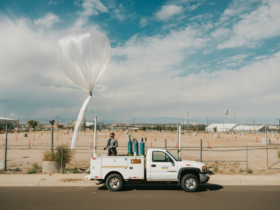
A technician deploys one of Urban Sky’s observation balloons in California. Balloon-based sensors can stay aloft for days at a time, providing first responders with a birds-eye view of active fires. (Image Credit: Urban Sky)
12/23/25 – An aerospace startup is working with NASA to create a new tool for observing wildfires from the stratosphere, setting the stage for a future in which first responders will have consistent, secure access to real-time data describing active burns.
Urban Sky, based in Denver, Colorado, is using a grant from ESTO’s FireSense Technology (FireTech) program to create a balloon-based thermal infrared sensor that can spot a nascent wildfire from its perch 11 miles (18 kilometers) above the surface. The sensor, known as “Hot Spot,” can scan 3,000 acres of wilderness in a single minute with a spatial resolution of 5 meters per pixel. It also features a communications system that will help fire fighters stay in touch with one another and their main base of operations.
Using AI algorithms, the system will also be capable of automatically identifying and downlinking particularly useful data to first responders, as well as charting its own flight path.
Urban Sky has spent the past six years developing instrument payloads for stratospheric balloons. These balloons are quick to deploy and can stay aloft for days at a time, providing end users with a steady stream of surface data.
For fire prone areas, these balloon-based sensors could serve as a near-constant lookout for wildfires. In an emergency, they could be dispatched to provide firefighters with a birds-eye view of the fire they’re fighting and a reliable communications system for receiving new data.
Hot Spot includes a compact multispectral imager with a modified sensor array that will allow the instrument to better differentiate between thermal signatures from wildfires and thermal signatures from non-fire sources. The new imager will also help Hot Spot better measure the health and density of an area’s surface vegetation – a key variable for forecasting wildfire risk.
The mesh communications antenna, produced by a partner company, is tiny, weighing about as much as a AAA battery and taking up about the same amount of volume as a sugar cube. But it’ll have a huge impact on firefighters’ ability to receive and share new information about a fire.
“Through this communications hub, we’ll not only enable web-connected communication, but also direct communication to firefighters in the field, so they can see the data that’s being generated with our system,” explained Jared Leidich, co-founder and Chief Technology Officer at Urban Sky and principal investigator for Hot Spot.
Urban Sky has already validated much of its Hot Spot hardware. The team is finishing up several software components, including a visualization tool to display gathered wildfire data in an intuitive, user-friendly way.
Without FireTech funding, this novel sensor for observing wildfires wouldn’t exist. As a key element of NASA’s FireSense program, FireTech bridges the gap between technology producers and end users, validating new tools for wildfire management through comprehensive field campaigns and working closely with wildfire managers to make sure these tools suit their needs.
“Very genuinely, FireTech enabled this system to exist,” Leidich said.
Gage Taylor, NASA Earth Science Technology Office